
This Marine Corps graphic depicts the invasion plan and lays out the geography of the island. Mt. Suribachi lies at the extreme southern tip with the initial day’s landing beaches trailing off to the northeast. Our visit included the rough vicinity of Airfield No. 1, of which nothing remains of the Marines’ Day one objective, Red and Yellow Beaches, Mt. Suribachi, and the Okita area where GEN Kuribayashi’s command bunker was located. The current Japan Self-Defense Force base on Iwo-to lies roughly over the old Airfield No. 2. As indicated by the graphic key, all distances on Iwo Jima are short as the island is just over 8 square miles in size.
Marine planners expected fighting to last for only five days, but the defenses laid out by Kuribayashi would take 38 days to overcome at a loss of 26,040 casualties, nearly a quarter of all Americans involved in the operation. The Marines took approximately 40 casualties for each meter of beach gained on the first day of the invasion. Of the 22,786 Japanese defenders, only 1,083 would survive the conflagration. Less than half of Japanese remains have since been recovered and Iwo-to is considered that nation’s largest national cemetery.
For more on my visit, check out the blog entry “My Brush with Uncommon Valor”.

The view of Red, Yellow, and Blue beaches (right to left) taken from the first ridgeline.

A view of Mt. Suribachi from the first ridgeline, just beyond the military crest. Green and Red Beaches are just visible to the left.

Mt. Suribachi from the waterline. Note how steeply the terrain rises to the right. The “sand”—really black volcanic ash—is very deep here and difficult to traverse even unburdened. The figure in the near distance provides some idea of both the elevation of the sand and the rapid rise of the topography beyond.
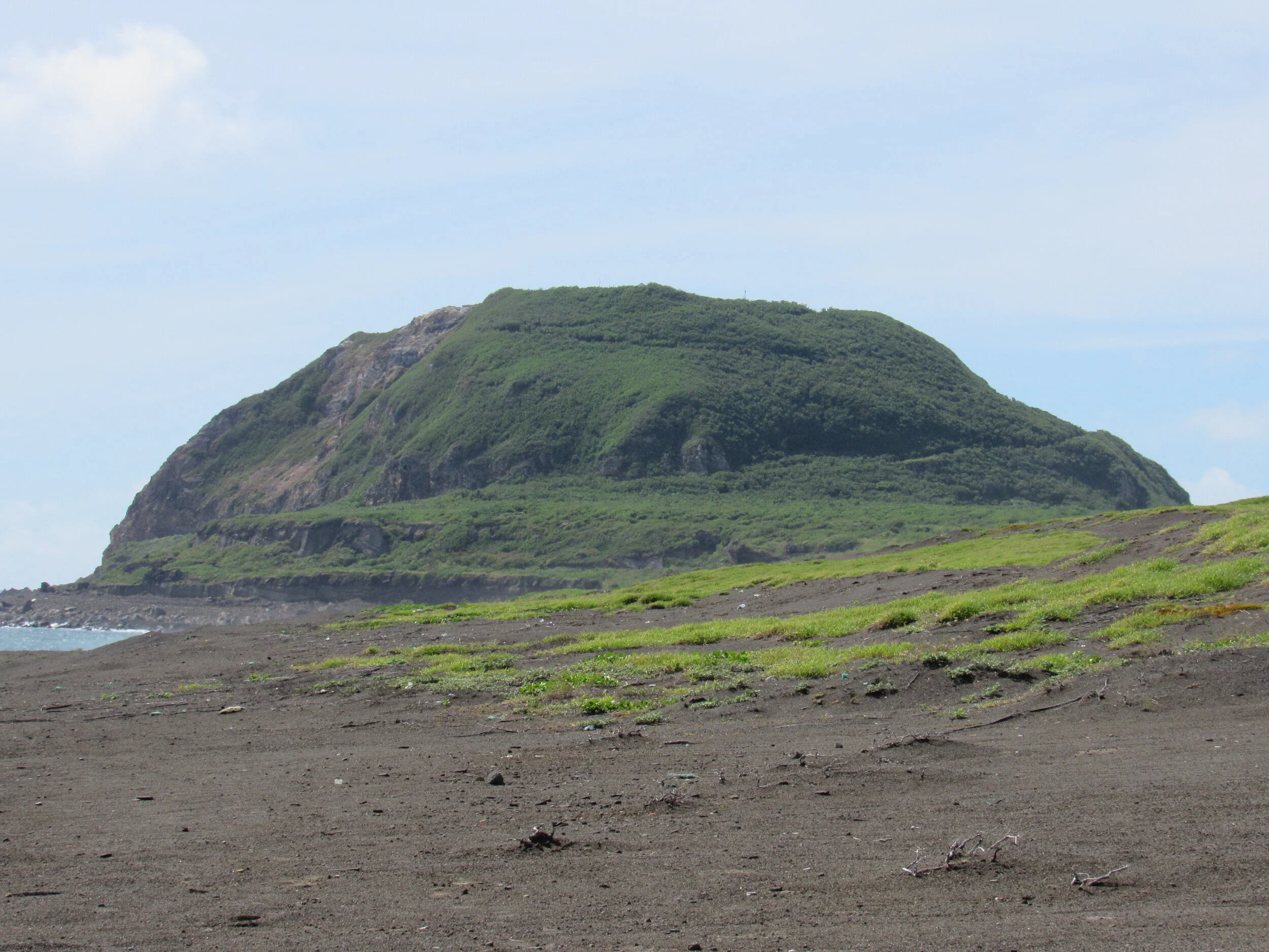
Closer view of Mt. Suribachi looming over Red and Green Beaches. It’s every bit as steep as it looks! At the time of the invasion, air and naval bombardment had largely denuded Suribachi of its foliage, leaving it one humongous, solid rock.

The heights, cliffs, and caves to the north formed, with Suribachi, the perfect crossfire for cannons and machine-guns. Inland Japanese artillery, firing from thoroughly camouflaged and fortified positions, were registered to fired upon the beaches with great accuracy, creating a variation of hell on earth for those Marines caught in the maelstrom.

Another view of the rapid rise in elevation from just above the waterline. This beach is not easy to traverse even today—without being fired upon—and takes much longer to reach the high ground than it appears it should.

The view from the waterline west toward the first ridgeline. There are actually multiple minor ridges of deep black sand running parallel to one another, complicating any attempt to cross the beach, but as this photo shows, it doesn’t appear that way at all.

Further north but still at the waterline, the first sand dune blocks all but a tiny glimpse of the first ridgeline (the foliage barely visible here) west of Yellow Beach. This dune did not, however, offer much cover from either Suribachi to the south, or the cliffs to the north.

At the first ridge, the Imperial Japanese forces waited in well-prepared positions. This concrete pillbox has been thoroughly blasted to the point that its front aperture is no longer recognizable as being man-made. Having survived crossing the beach, the Marines pressed on to what they hoped was cover up above, but ran into this first defensive line instead, and vicious, close-in fighting erupted all up and down the line. Many of these positions were not sited to fire upon the beach, but were off-set, on the subtle reverse slope of the first ridgeline and dug into the second. This meant that naval gunfire—with its flat trajectory—was unlikely to have much effect, and many of these fortified positions would only become visible once the assaulting Marines cleared the military crest.

What looks like it used to be a Type-92 heavy machinegun remains in the pillbox above, still facing obliquely down the ridgeline toward Green Beach.

This large-bore cannon position on the lower reaches of Mt. Suribachi, has been blasted away, but the gun has survived in remarkable shape, all things considered. These guns kept the larger U.S. Navy warships at arm’s length and could, in a pinch, be used to fire upon ground troops as well. This position, however, faced the western beaches, perhaps saving it from the ravages of combat on that side of the steep volcano.

Just below the cannon position pictured above, this extensive bunker appears to be in great shape … but alas, we were not allowed inside!

The view of the island battlefield from atop Mt. Suribachi. The camera faces north with the first day’s landing beaches to the right and the western beaches to the left. The white buildings in the distance mark the approximate location of then Airfield No. 2. The road visible to right center tracks between the first and second ridgelines as measured from the eastern beaches. This is a tiny island, far too small to have witnessed a 35-day battle, but helps explain why the initial estimate was that the campaign would take only five days.

Shipwreck Beach on Iwo-to, these vessels are indeed left over from the 1945 battle, as are many remnants of the fight scattered around the island … including an undetermined amount of unexploded ordinance. This is not a place you stray from clearly identified—and cleared—trails.

View from atop Mt. Suribachi of the invasion beaches, from bottom to top: Green, Red, Yellow, and Blue.

The entrance to GEN Kuribayashi’s command bunker in the low highlands on the northern end of the island. Again, would have liked to go inside, but apparently much preparation work is required to allow such a thing and we were not allowed inside. That said, our guide mentioned that, while certain of the tunnels required passage on hands and knees, these generally linked large natural and man-made caverns and galleries within. Multiple positions were connected underground in this manner, a development that kept the defenders from being too terribly affected by the preparatory naval and air bombardment.

The Reunion of Honor cenotaph, situated just below the second ridgeline overlooking Yellow and Red beaches. This is where the annual Reunion of Honor ceremony takes place for veterans and representatives of both governments and both armed forces. This year’s COVID outbreak and subsequent travel restrictions made attendance by octogenarian veterans dangerous, so U.S. Forces Japan and the Government of Japan filmed the event so they could view the ceremony online from the safety of their homes.

The U.S. Marine Corps memorial atop Mt. Suribachi.