Namhansanseong (남한산성)
Sometimes referred to as the Great Wall of Korea, this massive fortress consists of 11.7 kilometers of stone, masonry walls, closely following the rugged terrain as Korean fortifications generally do. These long walls connect what are essentially five distinct peaks, creating a massive, hollow interior filled with numerous temples, palace compounds and several villages. The fortification served as the last refuge of Korean royalty, army and people for centuries, and ultimately was the very spot where a Korean king was forced to surrender his nation to invading Manchus in 1636.
Located along the strategic route from Busan to Seoul, there has been a fortification of one type or another there since 672 AD, with initial construction done by the Kingdom of Silla. The current version of the fortress was ordered built following the Japanese invasion in 1592, but was not completed until 1624. Modification and modernization continued at the fortress until the Japanese colonial period when the occupiers demolished large portions of the wall in 1907 as it had become a center for Korean resistance.
The huge fortification was featured in a 2017 Korean movie by the same name "Namhansanseong" (released in English, I believe as “The Fortress”). Not the most exciting of films, but highlights this remarkable feat of engineering and gives a good idea of the plight of the troops ordered to defend this bastion against the besieging Manchus.
The pictures which follow were taken over four distinct visits to the fortress. You can find more information on Namhansanseong here.
A revised note for potential visitors having now returned for the first time in ten years. The inside areas have become VERY commercialized, with shops, cafes, and restaurants taking the place of what used to be adequate parking. Thus, your best bet to visit Namhansanseong during the peak fall period is by bus, especially on the weekends, otherwise not only will you spend an inordinate amount of time trying to enter on the two roads which pass through the wall, but you’ll struggle to find a place to park once inside. Visiting during a weekday—even during peak season—turned out not to be a problem at all, though I’d still recommend starting early if you’re driving in order to find parking. All that said…a MUST visit while in Korea!
(click to view enlarged pictures)
Namhansanseong Map
This is a map of the fortress and its environs. It's as big as it looks, and several small villages exist within the long, snaking walls.
South Gate (Jihwamun)
If arriving at the base and climbing up from the southwest, this is your first real glimpse of the fortress. The walls stretch up and over the nearest ridge lines in both directions from here.
It can be pretty steep here, but this first climb is the longest going clockwise around the fortress, and I still recommend visiting this way, especially if its your first time.
Western Command Post (Sueojangdae)
One of five original command posts at Namhansanseong, it is the only surviving example at the fortress. In 1624 it was only one story high, the second being added in 1751. From these locations military leaders were expected to command the defense of the massive fortress.
The first of many “secret” gates you encounter. This view from within the walls…
…and this one from the outside.
The West Gate (Uikmun)
There is a narrow path leading to this gate, but as you can see, the mountain is pretty steep at this point. From these walls it seems you're looking straight down into the tree-strewn valley far below. An arrow would carry a great distance in defense of this position.
View approaching the Western Gate from the inside.
…and from outside. The trail leading up to this portal is pretty steep, a theme you’ll see repeated throughout Namhansanseong.
Yeonjubongongseong
A mouthful to be sure, and one of the most recently renovated segments of Namhansanseong. Here a narrow section of wall leads out through a secret gate to what can only be described as a miniature, almost stand-alone fortification. The peak--and by extension the masonry construction seated upon it--offers incredible sight lines in all directions. The narrow parapet itself features sharp drop-offs to either side, making any approach extremely difficult.
View from inside the secret gate.
And from outside.
This is the final stretch leading up to the small, fortified observation post above.
Looking back toward the fortress from the observation post.
The North Gate (Cheonseungmun)
Another gate opening onto a very steep descent. Just climbing up the hill wearing armor and carrying heavy steel weaponry would have been exhausting, to say nothing of fighting once you'd reached the top.
The most incredible Secret Gate
This particular gate empties onto an extremely narrow trail that scales, rather than climbs, the steep slope. These secret gates were designed to facilitate clandestine sorties by the garrison as well as providing a means of receiving logistical support and were fundamental to the Korean method of building fortifications. This one, however, would have been very difficult to use given the steepness of the terrain beyond the wall…all of which may have made it perfect for clandestine supply or the occasional sally out.
An inside view of one of Namhansanseong’s secret gates. Fairly humble, they were intended to facilitate supply and sorties against a besieging force, not caravans of pack animals and royal palanquins as with the larger gates. Even if such a gate were forced by the enemy, its easy to see that defending the portal would not be difficult for defenders.
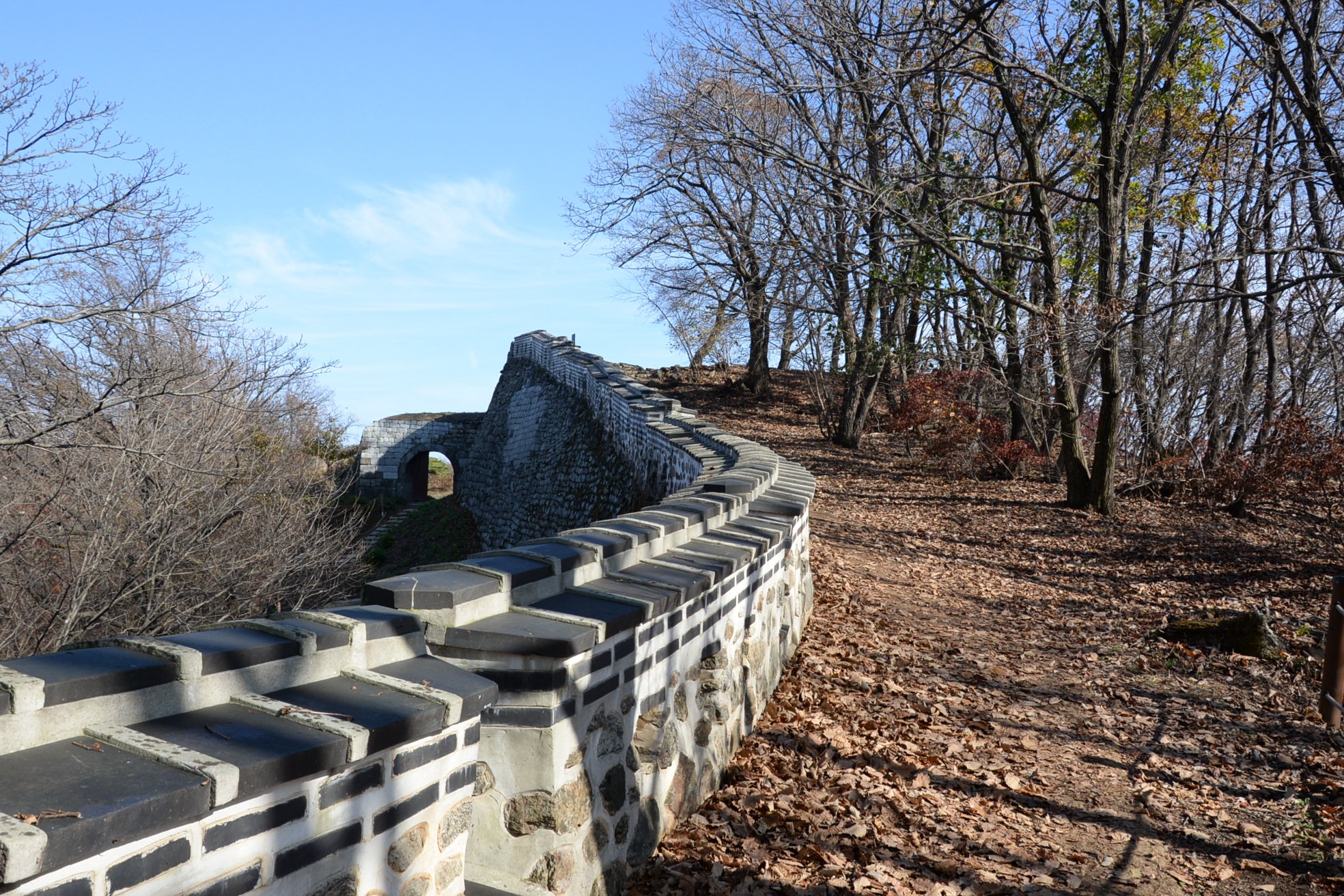
Stairs Along the Northeast Wall
Easily the steepest stretch of wall at Namhansanseong. You really feel for the garrison soldiers who probably climbed these stairs multiple times during any given guard shift. To say nothing of trying to do it when they were covered in snow and ice!
The limited time available to my latest visit led to a decision to traverse the walls “backward” meaning counter-clockwise. I’d never done this before and so despite having walked the entire length of the fortress walls several times before, I saw new things this time around. That includes this nasty and altogether uncomfortable descent…previously known to me as the most painful climb of a clockwise hike of the fortress!
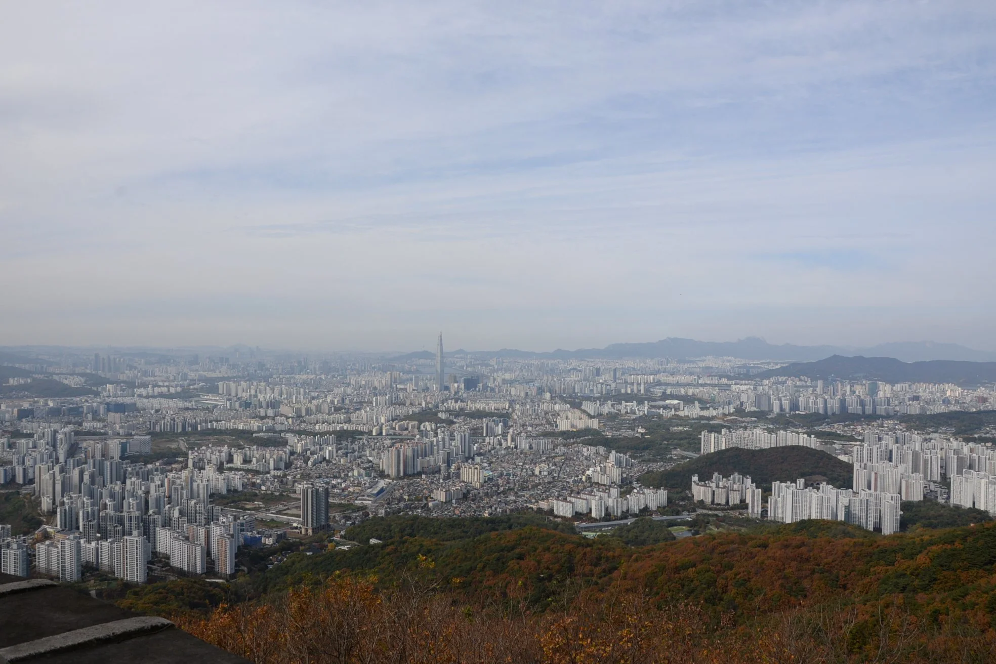
The city of Seoul lies just north of Namhansanseong, barely visible here. In Joseon times, Seoul was entirely situated north of Namsan Mountain and only in the last century spread south of those heights and then crossed the Han River. That last expansion, toward the Jamsil area, is what you see here. Incidentally, the monument stone erected in 1637 by the Manchus after their victory over Joseon, the Samjeondo, remains there, beside Lotte World Magic Island. Its original location was closer to the crossing point of the Han River used by the Manchus in their approach.
"Outer Fortress" (Bongamseong)
The wonderful reason to visit places like this in person is you get to "discover" a bit. Bongamseong was an outer fortress built in 1686 to help address what was considered to be a weakness in the fortress design, approach and attack through the mountains. Bongamseong defended against attack from the east, fortifying the extended ridge line in that direction and making approach up those narrow but traversable defiles much more difficult. I don't have many good pictures beyond this gate and a section of crumbling wall, as Bongamseong has not (yet?) been renovated and the stone can be difficult to pick out from the foliage in the photos I do have. That said, this is a really cool part of the fortress to explore, and I felt like a little kid again tramping around through the brush searching out ruined and overgrown walls, parapets, and gates. This section of Namhansanseong provides, perhaps, a better idea of the state of these fortifications prior to the massive renovation project that restored the walls to their former (and current) glory.
2024 note: They’ve actually done a lot of work clearing brush away from Bongamseong’s walls and rebuilding collapsed gates. To the point where much of the extended fortress is not only easily visible, but easily traversible…unlike my first experience there where I felt like I was cutting trail through wilderness bush!
This is the first indicator that you’re approaching something new and interesting. The gate visible here is actually outside the walls of the main fortress…and locks from the other side!
If you expand this photo and look carefully, you can see the trace of this dramatic expansion out beyond the renovated main walls of the fortress. This was the state of all Namhansanseong before renovation began on the incredible site in the 1970s.
Roughly the same picture as above but taken in November 2024. They’ve done an incredible job removing the brush which had spent 200 years trying to swallow up the beautiful walls of Namhansanseong. The outer fortress is much more visible now, and much more of it is accessible without a tribal guide and sherpas!
They’ve done such a good job restoring the rest of Namhansanseong that it’s hard to imagine the entire circuit of walls and gates looking like this just 50 years ago. That said—and call me crazy—I find a certain elegant beauty in these unpreserved sections and kinda hope they leave some of it as is.
Last time I visited only the larger sections of this gate were standing, with no masonry overhead, the stones long ago having been carted off elsewhere. I walked right through almost without even noticing I’d passed through the wall. They’ve since rebuilt this entire gate—to say nothing of this section of the outer fortress—and it looks amazing!
The rebuilt gate from outside. Would have preferred a better, wide-angle picture, but the steep drop-off behind me made that risky…at best.
All of this was so overgrown with brush the first time I came here you couldn’t really even picture the full extent of the walls. Much of the restoration work on the outer fortress has been just clearing away the long-term growth and allowing the walls to once more see daylight and the few visitors who venture this far off the usual hiking trails.
This section at the far end of the outer fortress features rebuilt crenellations as well, though this was a theme throughout our hike as Namhansanseong is getting the first facelift its seen in decades, marked by the white, as yet unweathered mortar.
Heading back toward the main fortress I couldn’t help but capture this sudden rise in the wall. Like with the previous observation post, the walls linking the main fortress to the outer one run along a steep but very narrow ridgeline. This is its narrowest point.
Later Additions
At three locations along the southern section of the fortress were later additions to the fortress reflecting changing technology and thinking about defensive works in general. These three bulbous constructs--like the one pictured here--extend the fortress walls and reduce to a minimum the dead space an attacker could use to approach the ramparts. These additions are all fitted with cannon revetments designed to facilitate fires directed down the steep approaches.
Halfway up to the top. If traversing Namhansanseong in a counter-clockwise fashion, this section is by far the steepest and longest…and will make you reconsider this and other life choices!!
These holes in the wall were later additions and allowed the employment of small cannon, directed at the high ground directly facing this section of the fortress.
The low position of the gunports give some idea of how small Joseon era gun mounts—and the cannon they conveyed—actually were.
East Gate
The wall just west of the East Gate has been removed to allow the passage of the road into the south side of Namhansanseong. This is what creates the “cut-away” look from this side of the gate complex. The wall rises dramatically east of this gate and you head up toward some of the highest points of the massive fortress.
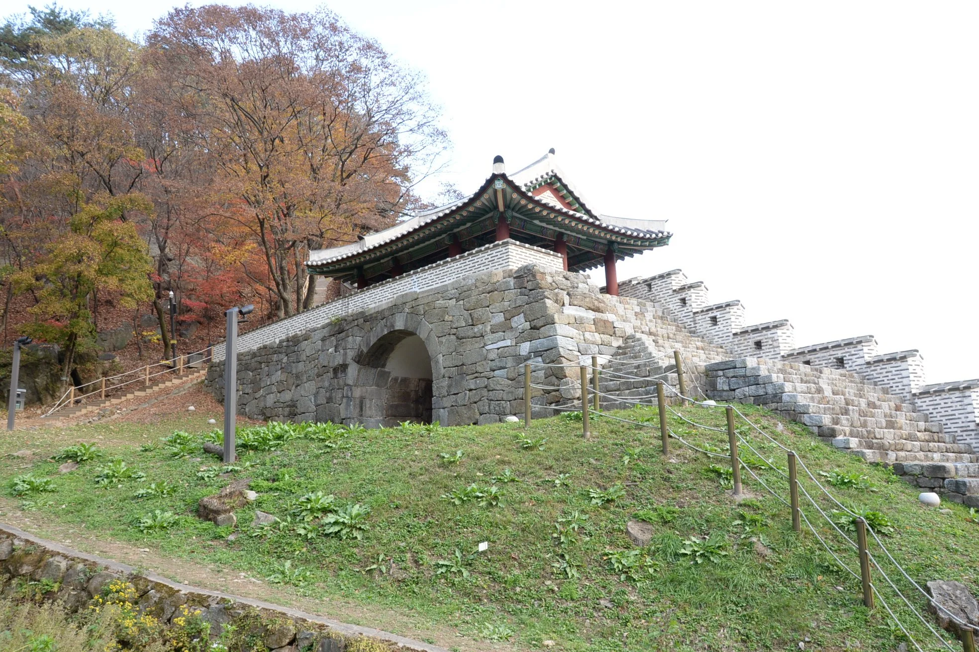
Near the East Gate—the most accessible by far—there is a water gate to facilitate drainage…
…as well as a secret gate to facilitate sallies out against a force assaulting the East Gate itself.
Along the Southeastern Wall
This section of the wall was the last of the main fortress to be repaired when I first visited, making it the youngest. It’s a beautiful hike in and of itself with lots to see, including a couple more later additions to the fortress.
A second extension undergoing restoration work.
And a third extension. Each of these seems sited to cover otherwise dead space out of sight from the main walls, which would have allowed attackers to get close without being detected.
My favorite view of Namhansanseong, descending toward the South Gate.
Inside the South Gate (Jihwamun)
This gate lies nearest the tourist facilities to include many restaurants (several featuring dishes made with the local specialty, tottori or acorn flour) as well as the usual selection of hiking and mountain biking shops.
2024 Note: The number of restaurants has exploded exponentially since I first visited and we struggled to find even one that was open. As well, they’ve restored the temporary palace that stands near the South Gate. Well worth a visit…just not on Mondays since its closed…and yes…we visited on a Monday!
Just a taste of the development near the South Gate. Restaurants stretch more-or-less all the way down to the East Gate. There’s lots to choose from and it seems a lot of folks just go up there for the food and not the hiking or—<gasp>—the history.
These memorial tablets recognize all the Magistrates, and thus Commanders, of Namhansaneong throughout history. The markers had been discovered, one-by-one, during the original 1970s restoration and brought together here.
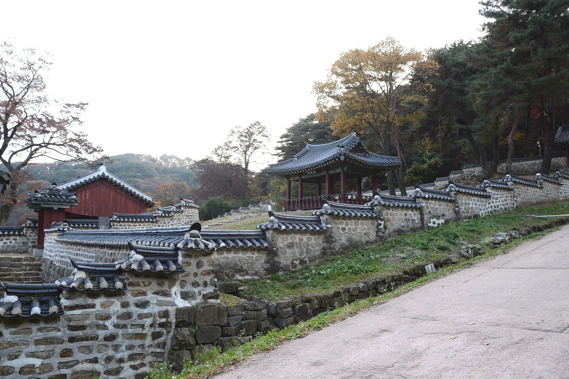
Temporary Palace
This was not only a place of refuge in time of national crisis but also a way-station, of sorts, during royal travels to the south or east from the capital. Like all palaces it was maintained by a full staff who must have been bored to death between visits! Though they did have access to incredible scenery and hiking trails. You’ll note all these pics are from the outside of the palace…next time we’ll not visit on a Monday!
The main gate to the palace.
Love the multi-tiered entrance here!
Very quaint pavilion at the back end of the palace.
And a diminutive rear gate providing access to the wooded mountainscape beyond.