ondalsanseong (온달산성)
Built near the end of Korea’s Three Kingdoms Period, this beautiful mountain fortress lay along the 6th Century A.D. fault line between Goguryeo and Silla. It’s construction has confounded scholars and researchers for years based on what appears to be a mixing of construction methods between the two competing kingdoms. Geographically, it’s position, on the south side of the Namhan River, would seem to provide further evidence of Silla origin. All that said, the most recent addition to that long-running debate has declared the fortress to be of Silla origin based on similarity of construction methods used at Samnyeonsanseong. Regardless of the ongoing debate, this elegant fortification—what I consider a more tactical design (compact, strategically placed, and difficult to access) than one designed for wider, civil administrative purposes—is only about 680 meters in circumference with three intact gates. Most of the walls are intact as well. More to the point, it’s a beautiful if steep hike, and a gorgeous representative of Korean Three Kingdoms fortifications at the height of their sophistication.

First view of the fortress coming up through the thick underbrush of the steep hill.


Looking up along the southwestern wall, you can just see the pavilion nestled in the trees atop the hill. A modern construction, the original would likely have been taller, allowing a fuller view of the lower sections of the fortress.

The Eastern Gate taken from inside the fortress. It seems likely this was the fortress’s primary entrance.

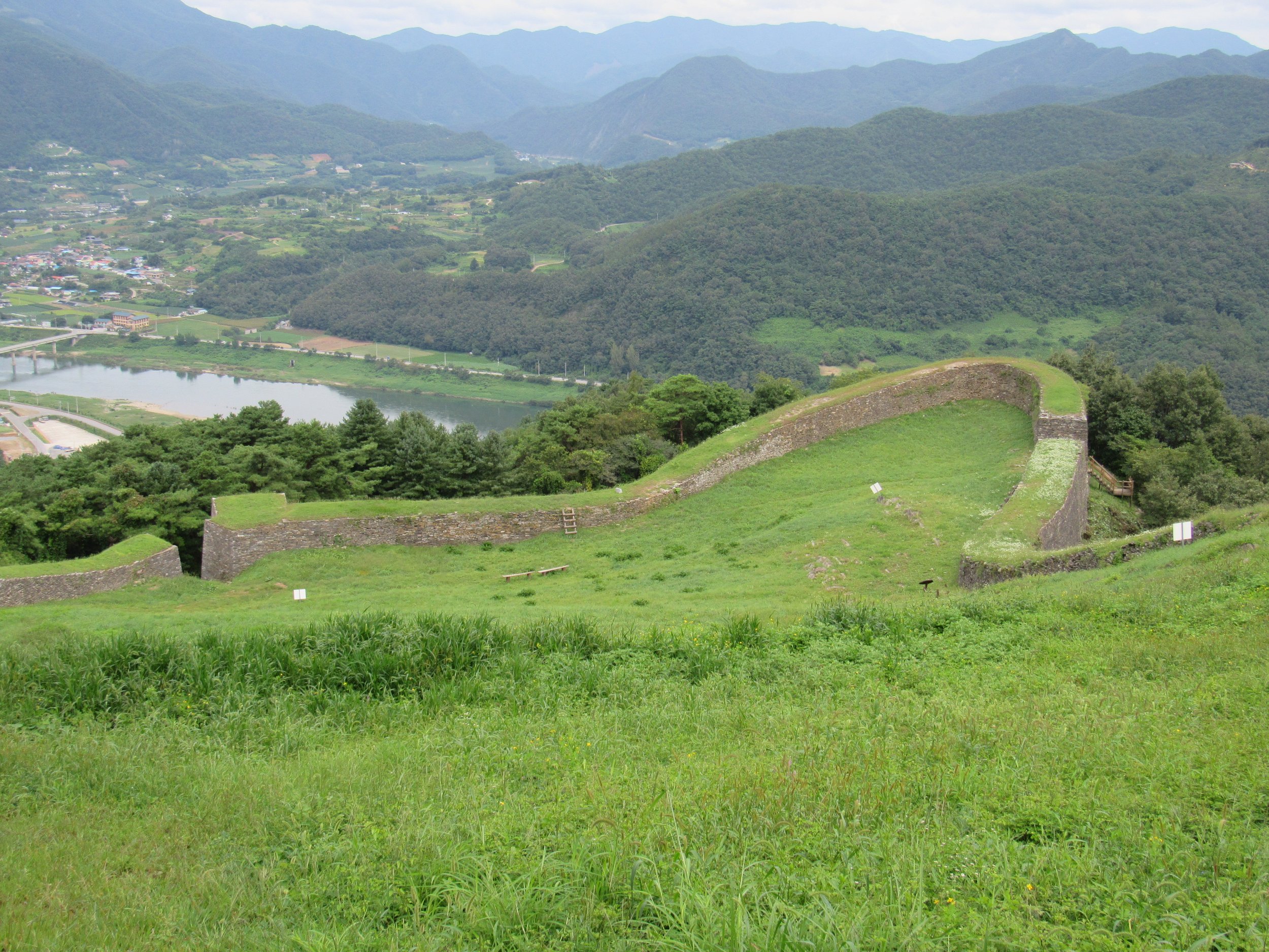
Looking from just inside the Eastern Gate toward the Southern Gate. The turf atop the walls seemed to me patently un-Silla from the period and would seem to indicate the presence of dirt “fill” within interior and exterior stone faces of the wall.

Characteristic of Korean Three Kingdom fortress construction is the ever-present attention paid to water management. Here you can clearly see the masonry-lined drainage to the left, with masonry “steps” guiding additional run-off water from the parapet back into the channel.

The Northern Gate includes a small cistern to catch run-off drainage from the fortress height and channel it out the gate, a fairly unique innovation.

The external drainage—where all that channeled water would eventually exit the fortress—along the massive and impressive southern wall.

The flat-rock construction of the castle walls is evident in the rounded wall section that gives Ondal Fortress its distinctive appearance.

The fill visible in a collapsed section of northeastern wall renewed my faith in the current hypothesis regarding fortress origin. Like at Samnyeonsanseong, it appears to be solid rock, and not earth fill.

Ondal Sanseong features a raised ridge that runs down the elongated shape of the fortress like a spine. The trees make it appear to be natural, but closer inspection at least hints at the presence of a flat-rock construction underlying the soil. If man-made, this spine would have provided a wonderful second line of defense—almost like a castle keep in western fortresses—with which to defend the walls. This picture is taken from that raised spine, looking down upon the elegantly curved Southern Gate.

Approaching the Northern Gate from the fortress height. The sandstone-colored rocks piled up inside the wall are believed to be defensive projectiles brought up to the castle from the river bed down in the valley. They are grouped together at intervals along the wall but the single greatest concentration is here. It’s unclear whether they were discovered in that location or collected and placed there during reconstruction.

The view from the pavilion atop the fortress. A wooden command post would have likely been constructed here as—with all trees removed—all three gates would be visible from this site. That said, it’s likely the command post would have been raised as this low position obstructs the view of the Southern Gate.